
Residential Engineering Services
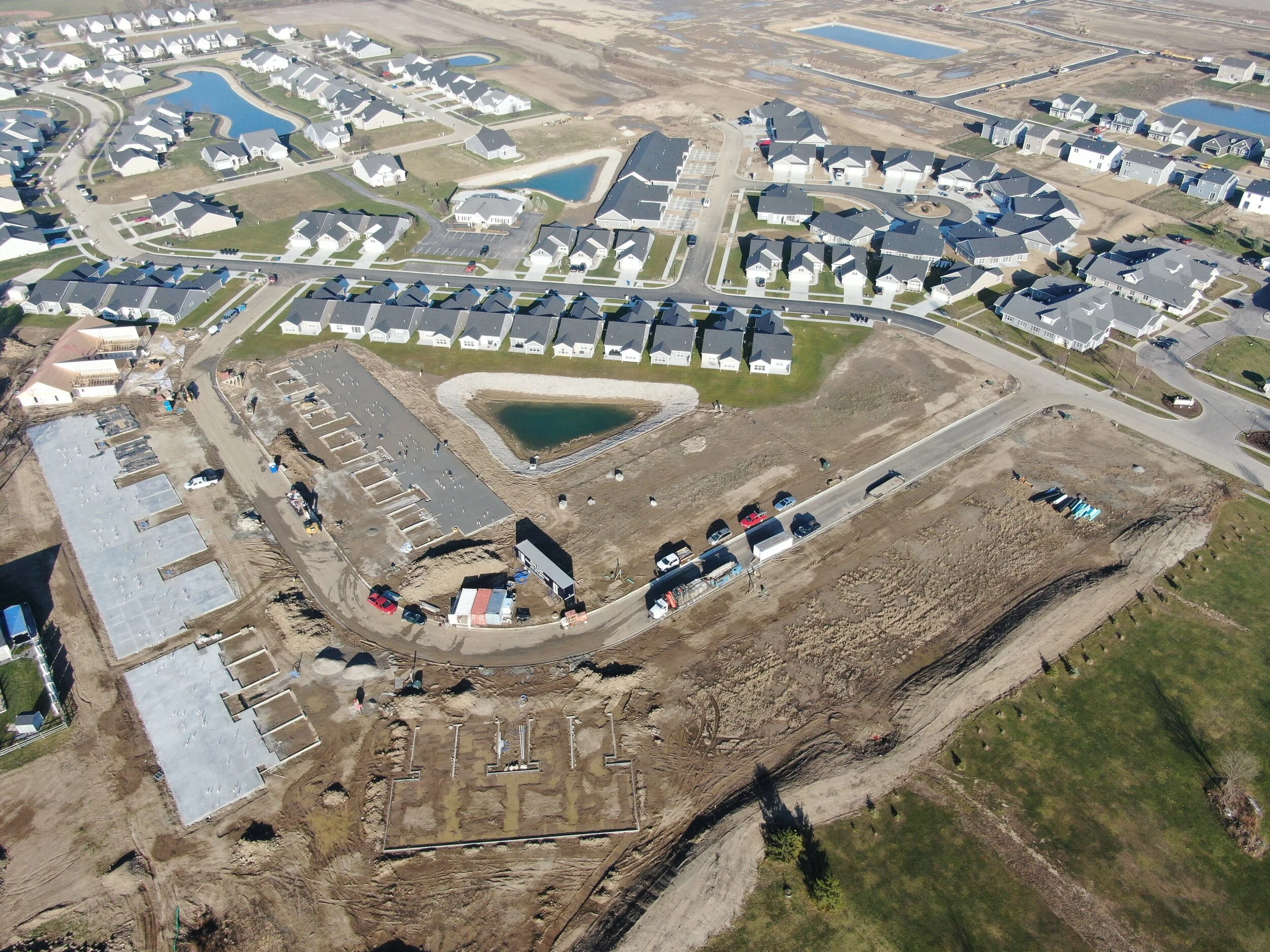
DGL has built a trustworthy reputation for delivering high-quality services to the residential sector. The scope of our experience ranges from single-family custom homes to multi-family developments, subdivisions, condominiums, and senior housing developments. We work closely with developers, homeowners, lenders, realtors, architects and contractors, to create solutions that realize their visions, all while meeting their budgets and the local and state regulations.
Our project leaders perform oversight of residential projects from our clients’ wish-lists through project completion. This starts with the survey team utilizing GIS data sources and the latest survey and mapping technologies, including GPS, Robotic Total Stations and Scanners to generate base mapping used to generate drawings from concepts to preliminary plats, full construction plans, construction staking, and as builts. These plans contain elements such as contours, mapped wetland areas, soil types, floodplains and existing utility mains, all of which are imperative to successful residential design.
DGL’s engineers use 3D modeling software to accurately design entire sites with roadways, building pads, walks, multi-purpose paths and trails, and structures. These models can then be used to show surface model contours, spot elevations, and slopes. All these aspects are imperative in determining a balanced earthwork site, determining detention volumes, and drainage areas.
Being in Northwest Ohio, we frequently hear people say, “When it rains, everything floods.” Our philosophy is that if the site is designed and modeled properly, it does not have to flood. DGL balances the earthwork while providing positive fall to drainage features which are designed to control the runoff. We utilize software to model the rain events and route the stormwater through detention and retention ponds to balance the rate of runoff and the stored water volume. The drainage system to get the water to the ponds is also designed using a combination of structures pipes, drainage channels, and other conveyance features appropriate for the water quality and quantity.
Because of our experience across the region, we are knowledgeable in the variations of building codes and zoning ordinances to ensure compliance with local and state regulations. We also relieve the burden of application processes by serving as our clients’ liaison to obtain appropriate project permits. Our engineers are a go-to resource for on-site septic/sewer systems design, as well as solving stormwater drainage issues. Our retaining wall portfolio is impressive and includes solutions that are unique and attractive.
Residential services include:
Lot Splits and Combinations
Manufactured Home Development
Machine Grade Control
Mixed Use Developments
Permitting (Municipal / State / EPA)
Post Construction Stormwater Management
Preliminary and Final Plats
Project Management
Residential Planning and Layout
Offsite Road Improvements
Road Design and Planning
Retaining Wall Design
Storm Sewer Design
Sanitary Sewer Main Extensions
Sanitary Lift Stations
Traffic Impact Studies
Topographical Surveys
Water Main Extensions
Master and Conceptual Planning
ALTA/Land Title Surveys
As-Built Surveys
Boundary Surveys
Campground Planning and Design
Conceptual Site Planning
Condominium Plans
Control Surveys for Aerial Mappings
Construction Staking
Detention/Retention Design
Earthwork Calculations
Erosion and Sedimentation Control Plans
FEMA Flood Certificates
Flood Studies
Geographical Information Systems (GIS)
Global Positioning Satellite (GPS) Surveys
Mass Grading Plans
Hydraulic Analysis Studies
On Site Sewage Treatment Systems