
River’s Edge Senior Housing Development
Client - Ridgestone Builders
Location - Perrysburg, OH
Services - Survey, Facility / Site Development, Construction / Technical
Market - Residential
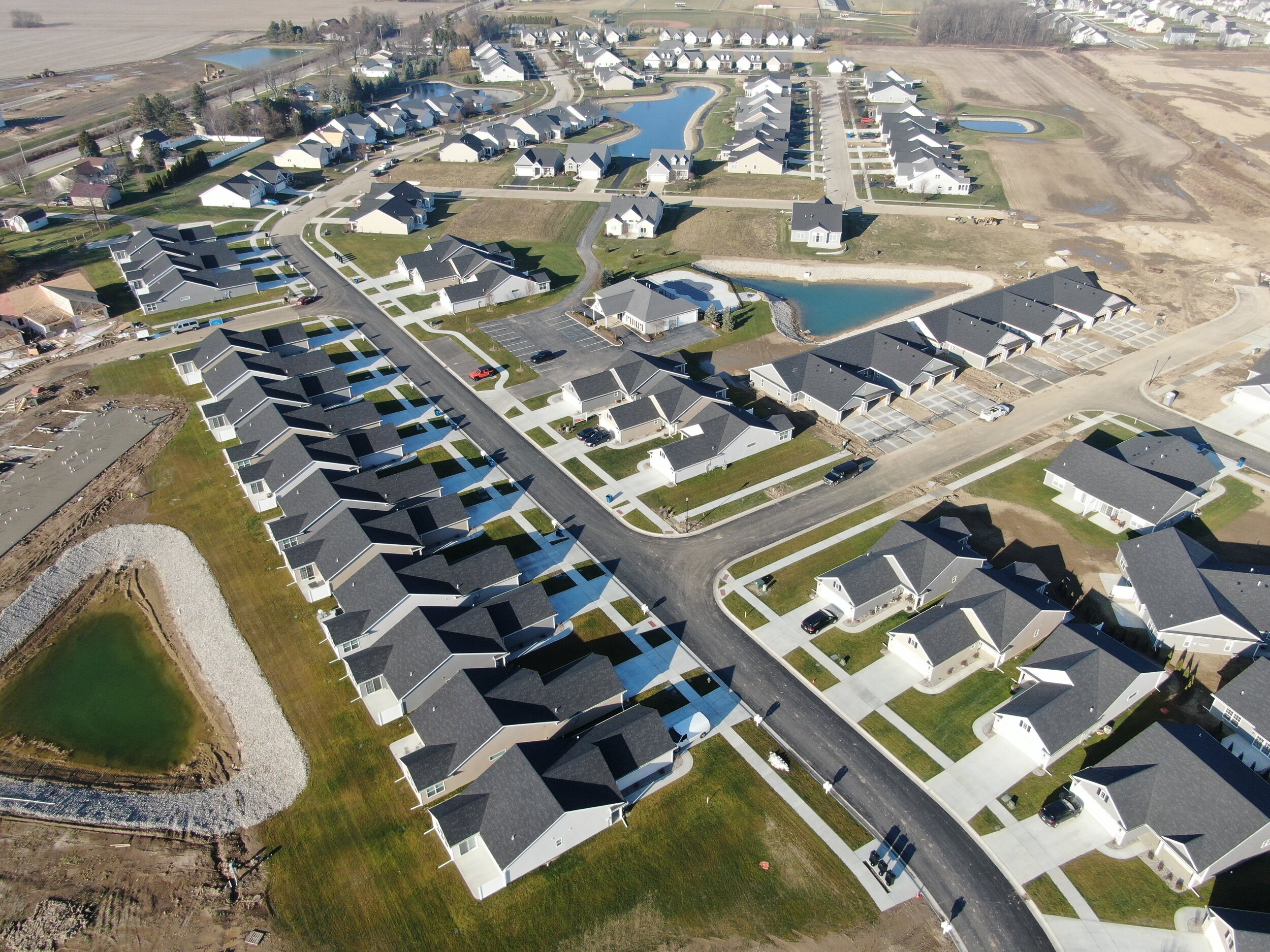
Ridgestone Builders contacted DGL to assist in the development of the River’s Edge Senior Housing Development in Perrysburg. DGL’s scope of work included boundary and topographic survey; site design for the entire development, including grading, drainage and utilities; retention pond and drainage designs, phased construction documents for permitting and construction of the development; construction staking and layout for each phase; individual plot plans for the multifamily unit building permits; building staking and pinning the footers, and Roadway Dedication Plat to dedicate the streets as public roadways and utility easements.
This project involved the conceptual layout of a graduated assisted living neighborhood for residents who need some in-home health care assistance but are still able to live independently. These homes consisted of multiple single-family homes, duplexes, and multifamily buildings with 4, 6, 8, and 10 units per building. The various sizes of buildings were grouped to form a community feel of single-family homes along the main street running through the development. Duplexes were focused around a cul-de-sac to get a slightly larger building and the feel of residential subdivision development. Larger multifamily units were constructed along the remaining streets to give more of the feel of a downtown area. Many of the units were also arranged to back up to the retention ponds with fountains to provide a relaxing view from the units and rear patios.
The design of the site involved modeling the road profiles and the site grading to provide dirt numbers for budgeting and for drainage and retention calculations. The storm, sanitary, and water mains were also modeled for conflict analysis and presentation in the construction drawings. The models were utilized to verify that all the units were provided with handicap accessible routes from the front door to the garage and the street sidewalks keeping the slopes below the requirements for ramps. These models were utilized for machine graded control earthwork during construction in addition to provide the surface contours, slope labels, and spot elevations for the development construction drawings and the plot plans for the individual building permits and reviews by the building department.
