
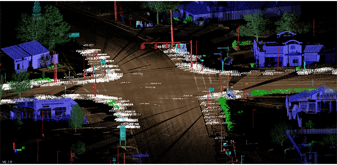



DGL performed topographic and existing conditions base mapping along 6,500 linear feet of Hudson Drive, including 19 intersecting roads, to develop a 1-foot contour surface model. Utility field investigations, along with Ohio Utility Protection Service (OUPS) markings and available plans, were used to identify underground infrastructure. A boundary survey was completed along the project corridor, and public records research was conducted to retrace the limits of public right-of-way for the project.
To reduce traffic impacts and improve surveyor safety, DGL implemented three-dimensional scanning technology at the major Front Street and Graham Road intersections. This approach allowed the team to capture topographic and utility data from adjacent corners, keeping personnel out of harm's way while minimizing traffic disruptions.
Share This Project
Departments
Survey

Kent State Solar Array
Kent, Ohio

SEN-025 (PID 119654) – Fostoria, Seneca County, Ohio
Fostoria, Ohio

Sylvania Downtown Improvements
Sylvania, Ohio

W117th RTA Rail Bridge
Cleveland, Ohio